About the Project
Site description, objectives, monitoring infrastructure, and the science behind SMART Irrigation.


Newry, Central Gippsland
The SMART campaigns are conducted at a farm near Newry, located in the central Gippsland region of Victoria, approximately 210 km east of Melbourne. The Gippsland region (41,556 km²) is known for its stable climate, strong rainfall, and productive arable soils — hosting dairy, grain, fodder cropping, and horticultural industries.
The study area is an approximately 400 m diameter centre-pivot irrigation site (146°51′19″–46″E, 37°54′14″–38″S), monitored by Agriculture Victoria as a precision agriculture core site since 2016.
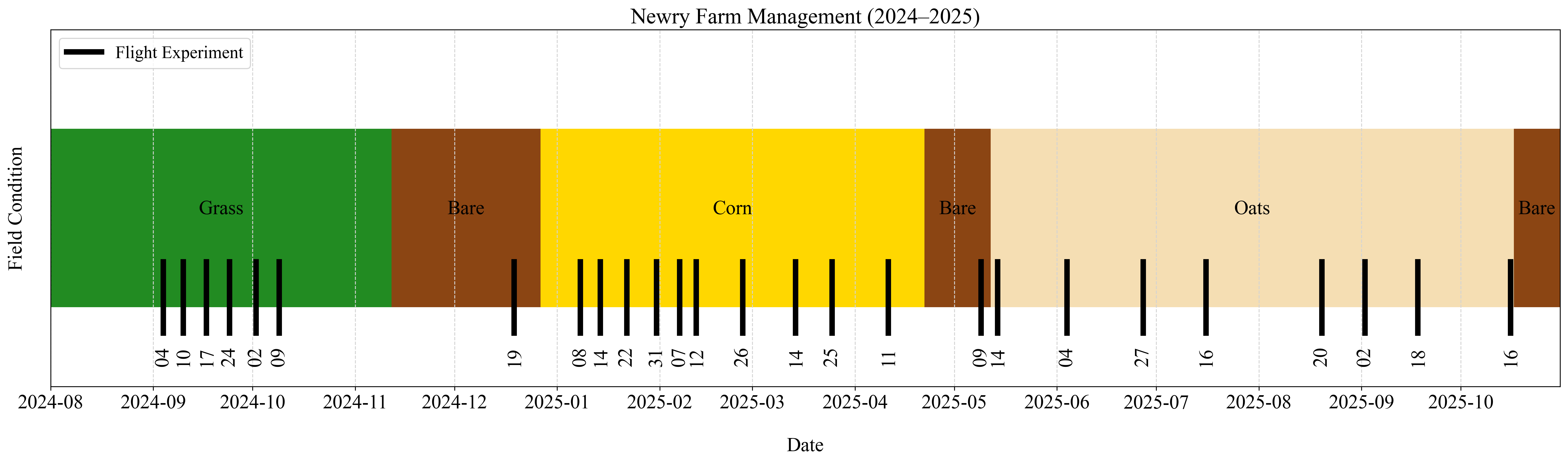
Farm Management & Flight Timeline
Overview of crop conditions at Newry farm from 2024 to 2025, with UAV flight dates marked for each campaign.
Three Core Goals
(i) Soil Moisture Mapping
Develop a high-accuracy algorithm to convert UAV PLSR brightness temperatures into 10 m resolution near-surface soil moisture maps across entire agricultural fields.
(ii) Irrigation Demand
Integrate surface soil moisture maps with the SWAN Systems water balance model to predict root-zone soil moisture evolution and derive optimal irrigation demand maps.
(iii) Variable-Rate Delivery
Close the loop by driving the centre-pivot irrigation heads with model-derived prescription maps, demonstrating real water savings and improved crop productivity.
Six Soil Moisture Stations
Installed October 2023, distributed to capture the full wetness gradient across the study area.


Each Station Monitors
Soil Moisture
9 Stevens Hydraprobes at 0–5, 5–10, 10–15, 15–20, 20–25, 25–30, 30–35, 35–40, and 57.5 cm depths
Soil Temperature
Unidata® 6507A/10 sensors at 1, 2.5, and 4 cm depths plus Apogee TIR surface temperature
Microclimate
Rainfall (tipping bucket), leaf wetness sensor — all logged continuously